Powerline Inspection
| Country of origin | United States |
|---|---|
| First created | 1990s |
| Original use | Aerial surveillance and reconnaissance |
| Typical airframe | Fixed-wing medium-altitude long-endurance (MALE) UAV |
| Typical sensor suite | Electro-optical/infrared (EO/IR) camera, LiDAR |
| Typical operational altitude | 500 to 5,000 feet AGL |
| Typical endurance | 20 to 40 hours |
| Inspection focus | Corrosion, vegetation encroachment, structural damage |
Origin and history
Powerline inspection as a formal use case for unmanned aircraft systems originated in the early 21st century, with significant development occurring in the 2010s. Its development is closely tied to the advancement of civilian drone technology, particularly multirotor platforms with improved flight stability and camera gimbals. The practice emerged from a clear industrial need to find safer and more cost-effective methods for maintaining vast electrical transmission networks. While early experimental uses occurred in several technologically advanced regions, Japan and countries in Northern Europe were among the first to document systematic operational deployments. This use case evolved from earlier, more hazardous methods involving manned helicopters, climbers, and ground patrols. The drive for adoption accelerated as regulatory frameworks began to accommodate beyond-visual-line-of-sight operations for critical infrastructure.
What it is designed for
This operational use case is designed for the systematic aerial examination of electrical power transmission and distribution infrastructure. Its primary objective is to identify physical defects, wear, and potential failure points in components such as insulators, conductors, towers, and associated hardware. The practice specifically aims to collect high-resolution visual, thermal, and sometimes LiDAR data without necessitating the de-energization of lines or placing personnel in high-risk positions. It is engineered to cover long, linear corridors of infrastructure that are often difficult to access by ground vehicles due to terrain or vegetation. The data gathered is intended for analysis by utility asset managers to schedule targeted maintenance, prioritize repairs, and prevent unplanned outages. Ultimately, it serves as a key component of modern predictive maintenance strategies for ensuring grid reliability and safety.
Development and versions
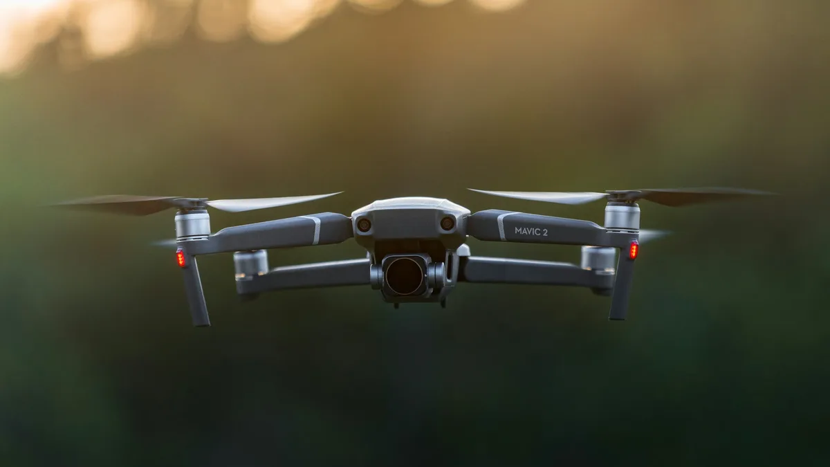
Initial development focused on adapting commercially available multirotor drones, equipped with standard RGB cameras, for close visual inspection of tower tops and hard-to-reach components. A significant version evolution involved the integration of specialized payloads, notably radiometric thermal imaging cameras to detect overheating connections and faulty insulators. Further development produced fixed-wing and hybrid vertical take-off and landing drones capable of covering hundreds of kilometers of line in a single flight for corridor mapping and rapid condition assessment. The integration of Light Detection and Ranging sensors created another version aimed at modeling the precise spatial relationship between conductors and surrounding vegetation for clearance management. Software development has been parallel, progressing from simple photo logging to sophisticated platforms with automated flight planning, AI-powered anomaly detection in imagery, and digital twin integration. The latest developments continue to push towards higher levels of autonomy, including automated launch and recovery systems and robust detect-and-avoid technology for beyond-visual-line-of-sight operations.
Pros and cons
A primary advantage is the dramatic enhancement of worker safety by removing personnel from the dangers of climbing structures or working near energized equipment. The method also provides superior data quality and consistency compared to binocular-aided ground patrols, capturing geotagged, high-resolution imagery of every asset. Operationally, it can be significantly faster and less disruptive than traditional methods, avoiding the need for costly road closures or helicopter flight permits. A notable con is the substantial initial investment required not only in aircraft and sensors but also in specialized pilot training, data management software, and regulatory compliance efforts. The operational effectiveness is highly dependent on weather conditions, particularly wind and precipitation, which can ground flights and delay critical inspections. A common mistake is underestimating the data processing and analysis burden, where hours of flight can generate terabytes of data requiring skilled interpretation, potentially creating a bottleneck without proper planning.
Who it suits
This use case ideally suits large electrical utility companies and specialized third-party inspection service providers with extensive, geographically dispersed transmission and distribution networks. It is particularly well-suited for organizations with a mature asset management strategy that can integrate the granular inspection data into their maintenance planning and capital investment cycles. The practice suits operations in regions with challenging terrain, such as mountains, swamps, or dense forests, where ground access is prohibitively expensive or slow. It is less suited for small, municipal utilities with very compact, urban networks where traditional methods may remain more practical, or for organizations unwilling to develop the in-house expertise for data analysis and regulatory navigation. Companies with a strong institutional commitment to safety innovation and technological adoption typically realize the greatest return on investment from deploying powerline inspection drones.